Ecuador reference library

Explainers

Background guides to Ecuador’s politics, economy, history, environment and everyday life.

← All resources

Evergreen context for understanding the people, institutions and issues behind the news.

Clear

Geography & Environment

Browse explainers

20 articles

"El Niño Costero": An Explainer

Understanding "El Niño Costero": An Explainer While the world often speaks of the "Global El Niño," Ecuador and Peru frequently deal with a more localized and often more intense phenomenon known as El Niño Costero (Coastal El Niño). Understanding this distinction is vital for residents of the Litoral and the Galápagos.

Series: Weather in Ecuador · Part 1

Read explainer →

Explainer: The Madden-Julian Oscillation (MJO)

If El Niño is the "marathon" of weather (lasting months or years), the Madden-Julian Oscillation (MJO) is the "sprint." It is a massive, fast-moving pulse of clouds and rain that circles the globe every 30 to 60 days. For people in Ecuador, the MJO is often the "hidden hand" behind a sudden week of torrential rain or a strangely dry "break" in the middle of the rainy season. 1. What is the MJO? The MJO is an eastwar…

Read explainer →

The Humboldt Current vs. El Niño: Understanding the Battle for Ecuador’s Coastline

In the tug-of-war for Ecuador’s coastline, the Humboldt Current and El Niño are the lead players. But as we start 2026, a third character—La Niña—is currently holding the rope. Here is the breakdown of why this battle matters for your wallet and your weekend plans, along with the latest forecast for the year ahead.

Series: Weather in Ecuador · Part 1

Read explainer →

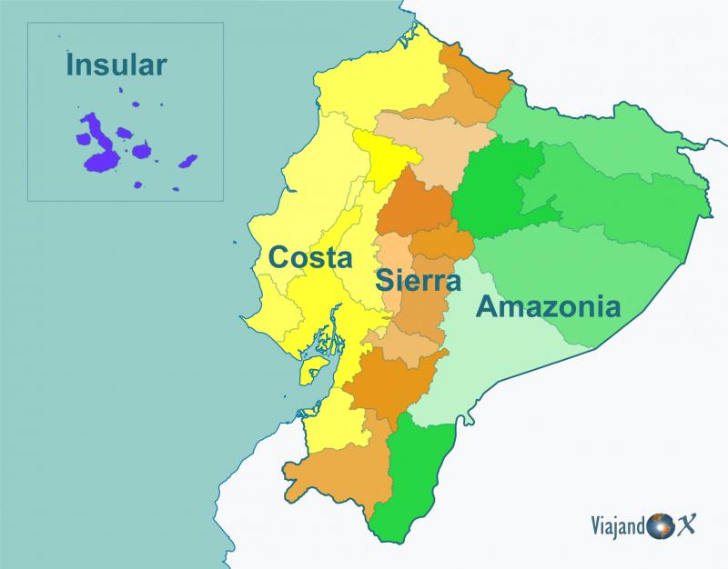
The “Three Ecuadors” (Costa, Sierra, Amazonía) — one country, three daily realities

People in Ecuador often talk like there are three countries inside one: the Coast (Costa), the Highlands (Sierra), and the Amazon (Oriente/Amazonía). That shorthand is real and useful—because the Andes act like a giant spine that shapes climate, travel, jobs, food, and even political priorities. Britannica describes Ecuador’s mainland as divided into these three main physical regions: Costa, Sierra, Oriente. (Encycl…

Read explainer →
History & Culture

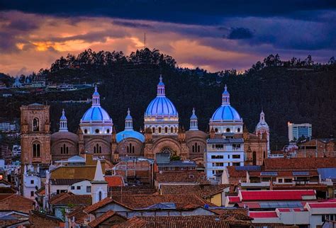
Sierra cities in the colonial era: Cuenca + Loja (and how they connected to Quito, the Coast, and the wider empire)

English When you zoom out from Quito, colonial Ecuador starts to look like a network: highland cities that managed land and labor, connected by roads to a coastal port that moved goods in and out. And in the south, Cuenca and Loja were key “nodes” in that network—smaller than Quito, but strategically placed. A simple clue: the 1563 royal decree that set up the Real Audiencia of Quito explicitly lists Loja, Cuenca, a…

Read explainer →
History & Culture

Quito (Colonial Era) — a walking version you can feel

let’s do a time-travel walking tour. Imagine it’s a clear morning and you’re walking Quito when it’s still a Spanish colonial capital: bells, vendors, officials in dark capes, and everyone reading the city’s rules in who stands where. Quito (Colonial Era) — a walking version you can feel Stop 1 — Plaza Grande (Plaza de la Independencia) EN: This is the city’s “front room.” In Spanish Quito, the plaza is where power…

Read explainer →

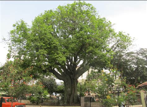
Explainer | The Ceibo (Ceiba trichistandra) — the Coast’s “big-hearted giant”

First: what people mean by “ceibo” on the Ecuadorian Coast On the Coast, when someone says “that’s a ceibo”, they’re usually talking about Ceiba trichistandra — the classic giant of Ecuador’s tropical dry forest (bosque seco) in the Tumbes region (Ecuador–Peru). (iNaturalist) (Tiny note because it confuses everyone at some point: there are other “ceibas” too — like Ceiba pentandra in wetter tropical areas — but the…

Read explainer →

Why sea temperature can “run the weather” on Ecuador’s coast

“Ecuador’s coastal weather is strongly influenced by sea surface temperature. Small shifts in ocean warmth change humidity, cloud formation, and the odds of storms—especially during ENSO phases like La Niña.” (CPC) If you live on the Costa (especially places like Manabí, Santa Elena, Guayas, Esmeraldas), you’ve probably noticed this pattern: Some weeks feel sticky and stormy (even if it’s “not supposed to”). Other w…

Series: Weather in Ecuador · Part 5

Read explainer →

Explainer - Vilcabamba, Loja: long lives, long holidays,

Vilcabamba, Loja: long lives, long holidays, and long arguments about “the gringos” 🌱 1. Where is Vilcabamba and why do people talk about it so much? Vilcabamba is a small parish in the canton of Loja, southern Ecuador, about 40 km south of the city of Loja, in a valley at roughly 1,500–1,700 meters above sea level. It sits where the Andean foothills start to relax toward the lowlands, with green hills, a mild “eter…

Read explainer →

Explainer- The Portoviejo–Manta–Bahía Corridor: One Coastal Region, Three Different Economies

The Portoviejo–Manta–Bahía Corridor: One Coastal Region, Three Different Economies (with Crucita, San Clemente, San Jacinto, Canoa, Chone, Calceta, Tosagua, Rocafuerte, Bahía de Caráquez & San Vicente in the background) 1. One corridor, many economies If you look at a map, Portoviejo, Manta and Bahía de Caráquez/San Vicente sit along one logical coastal corridor: farms and small towns in the interior, a capital city…

Read explainer →

Explainer - Ecuador and Oil

Here we go—Ecuador & oil, big-picture explainer. 1. Why oil still matters so much to Ecuador Oil is still one of the pillars of Ecuador’s economy, even if its relative weight is slowly shrinking. In 2023, crude petroleum was Ecuador’s single biggest export, worth about US$13.1 billion. At the same time, Ecuador spent about US$4.2 billion importing refined fuels (gasoline, diesel, etc.), because its refineries cannot…

Read explainer →

Ecuador Weather

Here we go — weather-nerd hat on. ☁️🌧️ 1. Why Ecuador’s weather feels “weird” compared to North America Ecuador sits right on the equator, squeezed between the Pacific Ocean and the Andes, with the Amazon basin to the east. That combination produces: Strong influence from ocean currents (Humboldt cold current and warm equatorial currents). A steep mountain wall that rises from sea level to >5,000 m in a short distan…

Series: Weather in Ecuador · Part 1

Read explainer →
Economy & Business

Explainer – The Economic Hierarchy of Ecuadorian Cities

[ratemypost] [ratemypost-result] (Article created by ChatGPT / Artículo creado por ChatGPT) 1. What this article does (and doesn’t) do 1. Qué hace (y qué no hace) este artículo EN:Ecuador doesn’t publish a perfect, regularly updated ranking of cities by GDP, so any list has to be approximate. In this explainer, created by ChatGPT from official census data and economic studies, we look at population (2022 census) plu…

Read explainer →

Explainer plus-Use of large rocks (riprap) to control coastal erosion

Uso de piedras grandes (riprap) para controlar la erosión costera Use of large rocks (riprap) to control coastal erosion 1. ¿Qué es el riprap? / What is riprap? ES:El riprap (o escollera) es una capa inclinada de piedras grandes y angulares colocadas en la orilla, frente a un malecón, carretera o edificio. La idea es que las rocas rompan la energía de las olas antes de que golpeen directamente la tierra o el hormigó…

Read explainer →

Explainer- Coastal erosion and sea-level rise on Ecuador’s coast

(with examples from San Jacinto & San Clemente) 1. What is coastal erosion? English Coastal erosion is the gradual loss of beach and land caused by waves, tides, currents and storms. Little by little, the shoreline moves inland: the beach gets narrower, dunes disappear, and sometimes roads, houses or seawalls collapse. On Ecuador’s Pacific coast, erosion is not new. Studies show that the central Manabí coastline has…

Read explainer →

Ecuador's place in the world

An explainer on Ecuador’s place in the world and how it deals with its main partners. 1. Big picture: a small country in a busy neighborhood Ecuador is a small, dollarized country on the Pacific, squeezed between Colombia and Peru and highly dependent on trade, migration and security cooperation with others.

Series: Ecuador-politics · Part 1

Read explainer →

Explainer -Ecuador and Mining

Here’s your explainer on mining in Ecuador, with Dundee / Loma Larga folded in. 1. Big picture: where mining fits in Ecuador’s economy Ecuador has large deposits of copper, gold and silver, similar in potential to Peru and Chile, but it is still a latecomer to large-scale mining. For decades, the extractive sector was basically oil + small-scale gold mining. Now metals are growing: Mining exports were a bit over USD…

Read explainer →

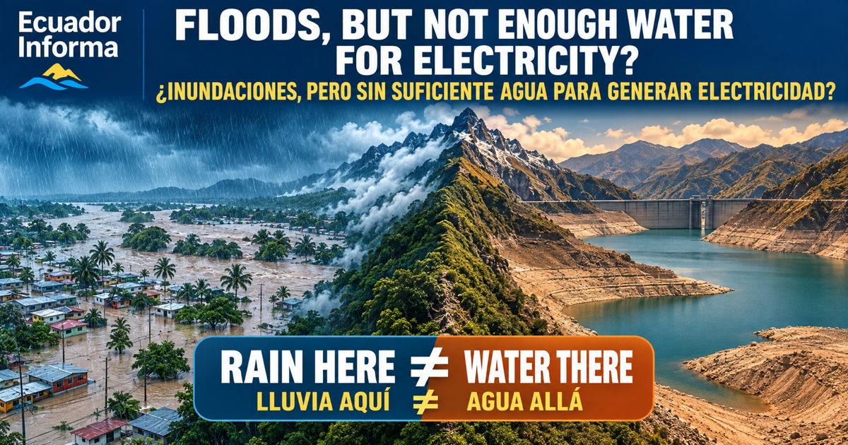
Explainer- Electrical system Nov 2025

1. Big picture: why Ecuador’s electric system feels “fragile” Ecuador’s electricity is officially a public service run mainly by the State, with a grid that covers almost the whole country. Most power still comes from large hydroelectric dams, backed up by diesel and gas plants, plus a small but growing amount of solar and wind. (Trade.gov) That model worked fairly well in wet years. But in 2023–2024, a combination…

Read explainer →